[Freeciv-Dev] (PR#12140) use sprites to draw the mapview grid
|
Complete.Org:
Mailing Lists:
Archives:
freeciv-dev:
February 2005: [Freeciv-Dev] (PR#12140) use sprites to draw the mapview grid |
|
[Freeciv-Dev] (PR#12140) use sprites to draw the mapview grid[Date Prev][Date Next][Thread Prev][Thread Next][Date Index] [Thread Index]
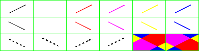
<URL: http://bugs.freeciv.org/Ticket/Display.html?id=12140 >

Here is a preliminary patch to use tileset sprites for drawing of the
mapview grid.

Apply the patch and drop grid.png into data/isotrident.  Then run the
game and use isotrident.

There are several reasons why we'd want to use sprites for this:

- Hand-editing can give better results (esp. the use of alpha for the
grid and hand-tweaking the border graphics).

- Using a sprite makes things more consistent (drawing a line may not be
the same on all platforms).

- It is possible (eventually) to have inset gridlines via sprites
(currently this works very poorly in iso-view).

- The border-drawing code is really obnoxious and it would be nice to
remove it.

Eventually we should use sprites for goto lines and other machine-drawn
decorations.

-jason
? blend.png
? fog
? fog.c
? fog.png
? foo
? terrain1.png
? data/isotrident/foo.png
? data/isotrident/grid.png
? data/isotrident/grid.xcf
? po/en.po
Index: client/mapview_common.c
===================================================================
RCS file: /home/freeciv/CVS/freeciv/client/mapview_common.c,v
retrieving revision 1.176
diff -u -r1.176 mapview_common.c
--- client/mapview_common.c 5 Feb 2005 19:26:38 -0000 1.176
+++ client/mapview_common.c 6 Feb 2005 05:51:41 -0000
@@ -853,19 +853,14 @@
canvas_x, canvas_y,
pdrawn[i].data.grid.citymode);
break;
- case DRAWN_BG:
- /*** Background color. ***/
- if (is_isometric) {
- canvas_fill_sprite_area(pcanvas, sprites.black_tile, COLOR_STD_BLACK,
- canvas_x, canvas_y);
- if (fog) {
- canvas_fog_sprite_area(pcanvas, sprites.black_tile,
- canvas_x, canvas_y);
- }
- } else {
- canvas_put_rectangle(pcanvas, pdrawn[i].data.bg.color,
- canvas_x, canvas_y,
- NORMAL_TILE_WIDTH, NORMAL_TILE_HEIGHT);
+ case DRAWN_AREA:
+ /*** A colored sprite area. ***/
+ canvas_fill_sprite_area(pcanvas, pdrawn[i].data.area.mask,
+ pdrawn[i].data.area.color,
+ canvas_x, canvas_y);
+ if (fog) {
+ canvas_fog_sprite_area(pcanvas, pdrawn[i].data.area.mask,
+ canvas_x, canvas_y);
}
break;
}
Index: client/tilespec.c
===================================================================
RCS file: /home/freeciv/CVS/freeciv/client/tilespec.c,v
retrieving revision 1.230
diff -u -r1.230 tilespec.c
--- client/tilespec.c 5 Feb 2005 19:26:38 -0000 1.230
+++ client/tilespec.c 6 Feb 2005 05:51:41 -0000
@@ -1458,6 +1458,34 @@
SET_SPRITE(tx.airbase, "tx.airbase");
SET_SPRITE(tx.fog, "tx.fog");
+ for (i = 0; i < EDGE_COUNT; i++) {
+ char *name[EDGE_COUNT] = {"ns", "ew"};
+ int j;
+
+ my_snprintf(buffer, sizeof(buffer), "grid.main.%s", name[i]);
+ sprites.grid.main[i] = load_sprite(buffer);
+
+ my_snprintf(buffer, sizeof(buffer), "grid.city.%s", name[i]);
+ sprites.grid.city[i] = load_sprite(buffer);
+
+ my_snprintf(buffer, sizeof(buffer), "grid.worked.%s", name[i]);
+ sprites.grid.worked[i] = load_sprite(buffer);
+
+ my_snprintf(buffer, sizeof(buffer), "grid.unavailable.%s", name[i]);
+ sprites.grid.unavailable[i] = load_sprite(buffer);
+
+ my_snprintf(buffer, sizeof(buffer), "grid.selected.%s", name[i]);
+ sprites.grid.selected[i] = load_sprite(buffer);
+
+ my_snprintf(buffer, sizeof(buffer), "grid.coastline.%s", name[i]);
+ sprites.grid.coastline[i] = load_sprite(buffer);
+
+ for (j = 0; j < 2; j++) {
+ my_snprintf(buffer, sizeof(buffer), "grid.borders.%c", name[i][j]);
+ sprites.grid.borders[i][j] = load_sprite(buffer);
+ }
+ }
+
for (i = 0; i < num_index_cardinal; i++) {
my_snprintf(buffer, sizeof(buffer), "tx.s_river_%s",
cardinal_index_str(i));
@@ -1942,9 +1970,10 @@
sprs->data.grid.citymode = (mode), \
sprs++)
-#define ADD_BG(bg_color) \
- (sprs->type = DRAWN_BG, \
- sprs->data.bg.color = (bg_color), \
+#define ADD_AREA(area_mask, bg_color) \
+ (sprs->type = DRAWN_AREA, \
+ sprs->data.area.mask = (area_mask), \
+ sprs->data.area.color = (bg_color), \
sprs++)
/**************************************************************************
@@ -2004,7 +2033,7 @@
ADD_SPRITE(get_unit_nation_flag_sprite(punit),
DRAW_FULL, TRUE, flag_offset_x, flag_offset_y);
} else {
- ADD_BG(player_color(unit_owner(punit)));
+ ADD_AREA(sprites.black_tile, player_color(unit_owner(punit)));
}
}
}
@@ -2659,6 +2688,98 @@
/****************************************************************************
+ Fill in the grid sprites for the given tile, city, and unit.
+****************************************************************************/
+static int fill_grid_sprite_array(struct drawn_sprite *sprs,
+ const struct tile *ptile,
+ const struct tile_edge *pedge,
+ const struct tile_corner *pcorner,
+ const struct unit *punit,
+ const struct city *pcity,
+ bool citymode)
+{
+ struct drawn_sprite *saved_sprs = sprs;
+
+ if (!sprites.grid.main[0]) {
+#if 0
+ if (ptile && tile_get_known(ptile) != TILE_UNKNOWN) {
+ /* Add grid. In classic view this is done later. */
+ ADD_GRID(ptile, citymode);
+ }
+#endif
+ } else if (pedge) {
+ bool known[EDGE_COUNT], city[EDGE_COUNT];
+ bool worked[EDGE_COUNT], blocked[EDGE_COUNT];
+ int i;
+
+ for (i = 0; i < 2; i++) {
+ struct tile *tile = pedge->tile[i];
+
+ known[i] = tile && tile_get_known(tile) != TILE_UNKNOWN;
+ city[i] = known[i] && player_in_city_radius(game.player_ptr, tile);
+ worked[i] = blocked[i] = FALSE;
+ if (city[i]) {
+ enum city_tile_type ttype;
+ struct city *dummy;
+
+ get_worker_on_map_position(tile, &ttype, &dummy);
+ switch (ttype) {
+ case C_TILE_EMPTY:
+ break;
+ case C_TILE_WORKER:
+ worked[i] = TRUE;
+ break;
+ case C_TILE_UNAVAILABLE:
+ blocked[i] = TRUE;
+ break;
+ }
+ }
+ }
+
+ if ((pedge->tile[0]
+ && map_deco[pedge->tile[0]->index].hilite == HILITE_CITY)
+ || (pedge->tile[1]
+ && map_deco[pedge->tile[1]->index].hilite == HILITE_CITY)) {
+ ADD_SPRITE_SIMPLE(sprites.grid.selected[pedge->type]);
+ } else if (!draw_terrain && draw_coastline
+ && pedge->tile[0] && pedge->tile[1]
+ && known[0] && known[1]
+ && (is_ocean(pedge->tile[0]->terrain)
+ ^ is_ocean(pedge->tile[1]->terrain))) {
+ ADD_SPRITE_SIMPLE(sprites.grid.coastline[pedge->type]);
+ } else if (draw_map_grid) {
+ if (blocked[0] || blocked[1]) {
+ ADD_SPRITE_SIMPLE(sprites.grid.unavailable[pedge->type]);
+ } else if (worked[0] || worked[1]) {
+ ADD_SPRITE_SIMPLE(sprites.grid.worked[pedge->type]);
+ } else if (city[0] || city[1]) {
+ ADD_SPRITE_SIMPLE(sprites.grid.city[pedge->type]);
+ } else if (known[0] || known[1]) {
+ ADD_SPRITE_SIMPLE(sprites.grid.main[pedge->type]);
+ }
+ }
+
+ if (draw_borders && game.borders > 0 && known[0] && known[1]) {
+ struct player *owner0 = map_get_owner(pedge->tile[0]);
+ struct player *owner1 = map_get_owner(pedge->tile[1]);
+
+ if (owner0 != owner1) {
+ if (owner0) {
+ ADD_AREA(sprites.grid.borders[pedge->type][0],
+ player_color(owner0));
+ }
+ if (owner1) {
+ ADD_AREA(sprites.grid.borders[pedge->type][1],
+ player_color(owner1));
+ }
+ }
+ }
+ }
+
+ return sprs - saved_sprs;
+}
+
+/****************************************************************************
Fill in the sprite array for the given tile, city, and unit.
ptile, if specified, gives the tile. If specified the terrain and specials
@@ -2700,19 +2821,19 @@
switch (layer) {
case LAYER_BACKGROUND:
if (ptile && tile_get_known(ptile) == TILE_UNKNOWN) {
- ADD_BG(COLOR_STD_BLACK);
+ ADD_AREA(sprites.black_tile, COLOR_STD_BLACK);
return sprs - save_sprs;
}
/* Set up background color. */
if (solid_color_behind_units) {
if (do_draw_unit) {
- ADD_BG(player_color(unit_owner(punit)));
+ ADD_AREA(sprites.black_tile, player_color(unit_owner(punit)));
} else if (pcity && draw_cities) {
- ADD_BG(player_color(city_owner(pcity)));
+ ADD_AREA(sprites.black_tile, player_color(city_owner(pcity)));
}
} else if (ptile && !draw_terrain) {
- ADD_BG(COLOR_STD_BACKGROUND);
+ ADD_AREA(sprites.black_tile, COLOR_STD_BACKGROUND);
}
break;
@@ -2793,9 +2914,9 @@
break;
case LAYER_GRID1:
- if (ptile && tile_get_known(ptile) != TILE_UNKNOWN && is_isometric) {
- /* Add grid. In classic view this is done later. */
- ADD_GRID(ptile, citymode);
+ if (is_isometric) {
+ sprs += fill_grid_sprite_array(sprs, ptile, pedge, pcorner,
+ punit, pcity, citymode);
}
break;
@@ -2876,9 +2997,9 @@
break;
case LAYER_GRID2:
- if (ptile && tile_get_known(ptile) != TILE_UNKNOWN && !is_isometric) {
- /* Add grid. In iso-view this is done earlier. */
- ADD_GRID(ptile, citymode);
+ if (!is_isometric) {
+ sprs += fill_grid_sprite_array(sprs, ptile, pedge, pcorner,
+ punit, pcity, citymode);
}
break;
Index: client/tilespec.h
===================================================================
RCS file: /home/freeciv/CVS/freeciv/client/tilespec.h,v
retrieving revision 1.100
diff -u -r1.100 tilespec.h
--- client/tilespec.h 5 Feb 2005 19:26:38 -0000 1.100
+++ client/tilespec.h 6 Feb 2005 05:51:41 -0000
@@ -30,7 +30,7 @@
* edge. The tiles are in unspecified order for the moment. */
struct tile_edge {
enum {
- EDGE_NS, EDGE_EW
+ EDGE_NS, EDGE_EW, EDGE_COUNT
} type;
struct tile *tile[2];
};
@@ -45,7 +45,7 @@
enum {
DRAWN_SPRITE, /* Draw a sprite. */
DRAWN_GRID, /* Draw the map grid now. */
- DRAWN_BG /* Draw a solid BG. */
+ DRAWN_AREA /* Draw a sprite mask area in a solid color. */
} type;
union {
@@ -67,8 +67,9 @@
} grid;
struct {
+ struct Sprite *mask;
enum color_std color;
- } bg;
+ } area;
} data;
};
@@ -313,6 +314,16 @@
*darkness[MAX_INDEX_CARDINAL], /* first unused */
*river_outlet[4]; /* indexed by enum direction4 */
} tx; /* terrain extra */
+ struct {
+ struct Sprite
+ *main[EDGE_COUNT],
+ *city[EDGE_COUNT],
+ *worked[EDGE_COUNT],
+ *unavailable[EDGE_COUNT],
+ *selected[EDGE_COUNT],
+ *coastline[EDGE_COUNT],
+ *borders[EDGE_COUNT][2];
+ } grid;
struct terrain_drawing_data *terrain[MAX_NUM_TERRAINS];
};
Index: data/isotrident.tilespec
===================================================================
RCS file: /home/freeciv/CVS/freeciv/data/isotrident.tilespec,v
retrieving revision 1.26
diff -u -r1.26 isotrident.tilespec
--- data/isotrident.tilespec 3 Feb 2005 19:28:41 -0000 1.26
+++ data/isotrident.tilespec 6 Feb 2005 05:51:41 -0000
@@ -54,6 +54,7 @@
"isotrident/terrain1.spec",
"isotrident/terrain2.spec",
"isotrident/tiles.spec",
+ "isotrident/grid.spec",
"misc/small.spec",
"trident/units.spec",
"isotrident/unitextras.spec",
Index: data/isotrident/grid.spec
===================================================================
RCS file: data/isotrident/grid.spec
diff -N data/isotrident/grid.spec
--- /dev/null 1 Jan 1970 00:00:00 -0000
+++ data/isotrident/grid.spec 6 Feb 2005 05:51:41 -0000
@@ -0,0 +1,42 @@
+
+[spec]
+
+; Format and options of this spec file:
+options = "+spec3"
+
+[info]
+
+artists = "
+ Jason Dorje Short <jdorje@xxxxxxxxxxx>
+"
+
+[file]
+gfx = "isotrident/grid"
+
+[grid_main]
+
+x_top_left = 1
+y_top_left = 1
+dx = 64
+dy = 32
+pixel_border = 1
+
+tiles = { "row", "column", "tag"
+ 0, 0, "grid.main.ew"
+ 1, 0, "grid.main.ns"
+ 0, 1, "grid.city.ew"
+ 1, 1, "grid.city.ns"
+ 0, 2, "grid.worked.ew"
+ 1, 2, "grid.worked.ns"
+ 0, 3, "grid.unavailable.ew"
+ 1, 3, "grid.unavailable.ns"
+ 0, 4, "grid.selected.ew"
+ 1, 4, "grid.selected.ns"
+ 0, 5, "grid.coastline.ew"
+ 1, 5, "grid.coastline.ns"
+
+ 2, 0, "grid.borders.s"
+ 2, 1, "grid.borders.n"
+ 2, 2, "grid.borders.e"
+ 2, 3, "grid.borders.w"
+}
|